
Cape Brett Track is one of the best coastal walks on North Island! I would totally repeat it every year If there were not so many other hiking options in…
Last Updated on December 2, 2023
What is the Routeburn Track?
The Routeburn Track is one of the most popular and amazing hikes among Great Walks in New Zealand. It is located on the South Island between the Divide and Glenorchy crossing Mount Aspiring and Fiordland National Parks.
It is personally one of my favorites because it allows you to see the most spectacular and diverse landscapes in 2-3 days, and it goes straight to the point (to the mountains) fast enough. I have completed the full hike as well as done it partially as a day walk.
In this article, I will talk more about the track and compare different options.
Routeburn Track Overview
This one-way track includes 32 kilometers and an elevation gain of 2,130 meters. It starts/ends in the town of Glenorchy (46 km from Queenstown) at the Routeburn Shelter and ends/starts at the Divide Shelter (which is located on the road between Te Anau and Milford Sound).
There are plenty of beautiful sights along this track:
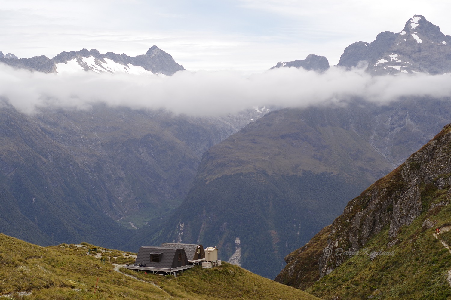
- Routeburn Falls Hut and the waterfall
- Harris Saddle and Lake Harris
- Conical Hill
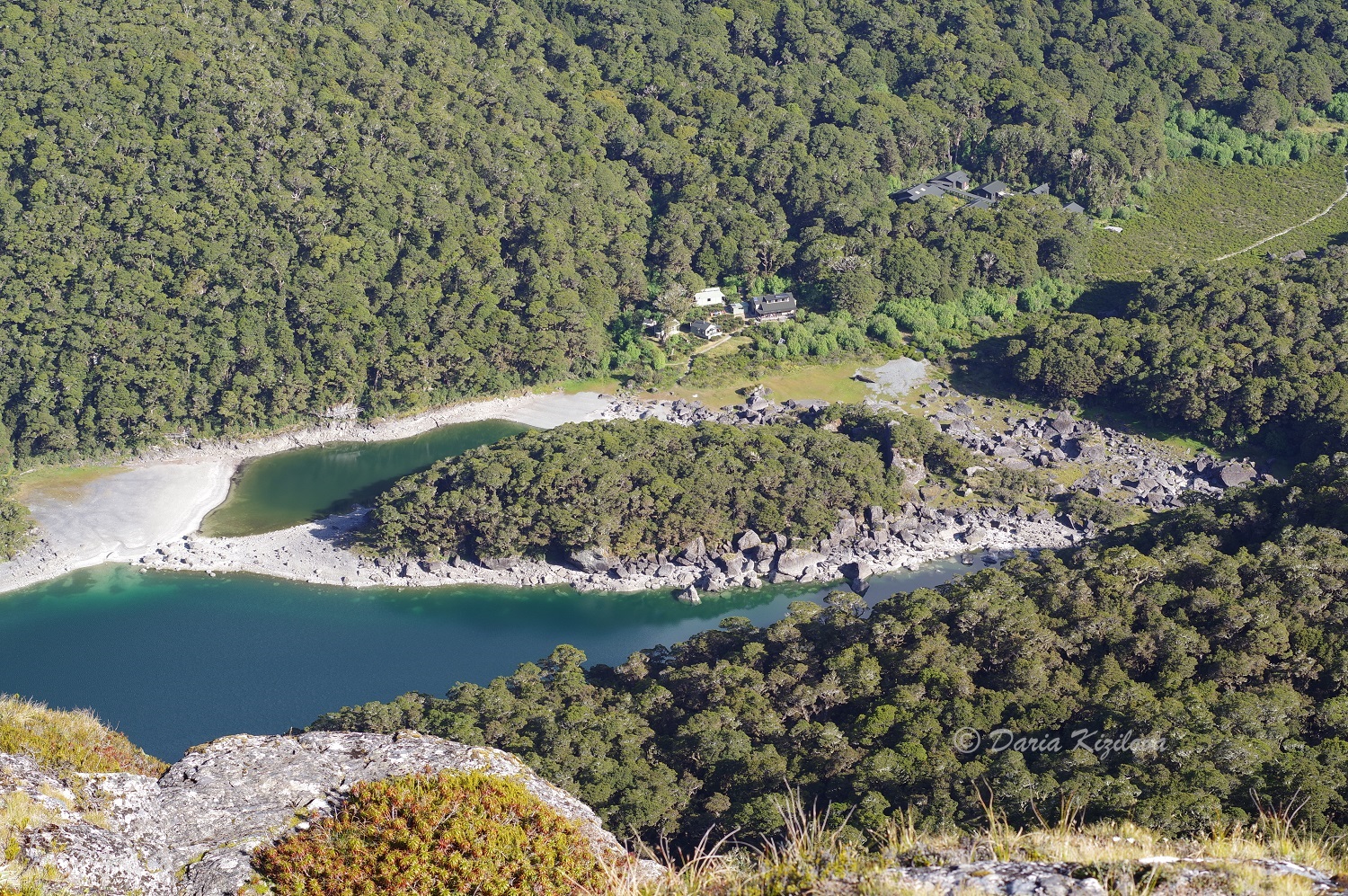
- Mackenzie Hut and Lake Mackenzie
- Key Summit
You can hike the track in either direction and have it done in 2 or 3 days. Some people actually hike the whole hike in one day but this may exclude the Conical Hill side trip.
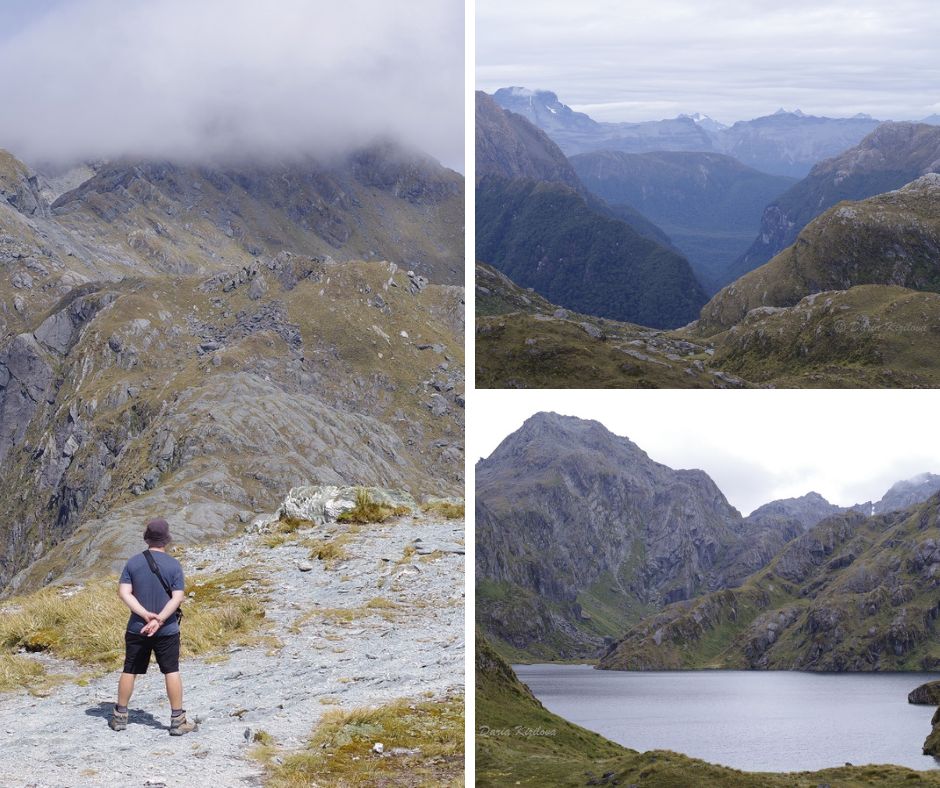
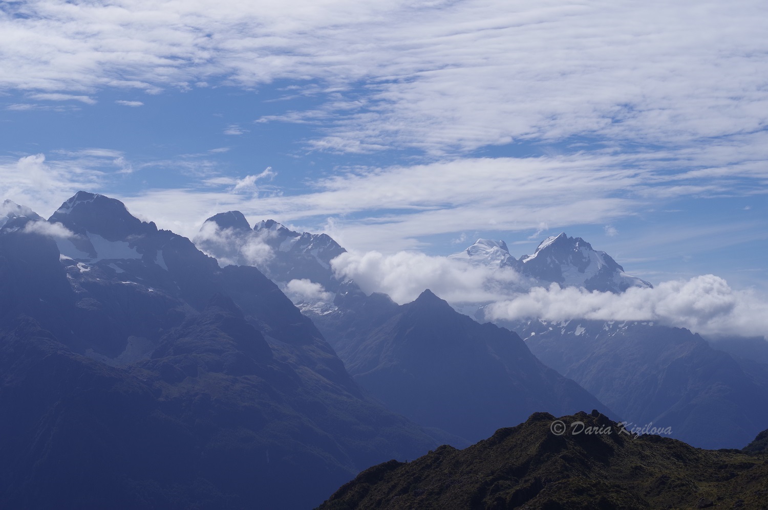
It doesn’t matter if you start at Routeburn Shelter or the Divide Shelter. The trail is built in the way that every day offers magnificent views. However, the best part starts on the Harris Saddle from Lake Harris and continues all the way to Mackenzie Hut. Key Summit is a little gem towards the end (or the start) of the hike.
Routeburn Track Elevation and Difficulty
Here’s the elevation profile for this hike.
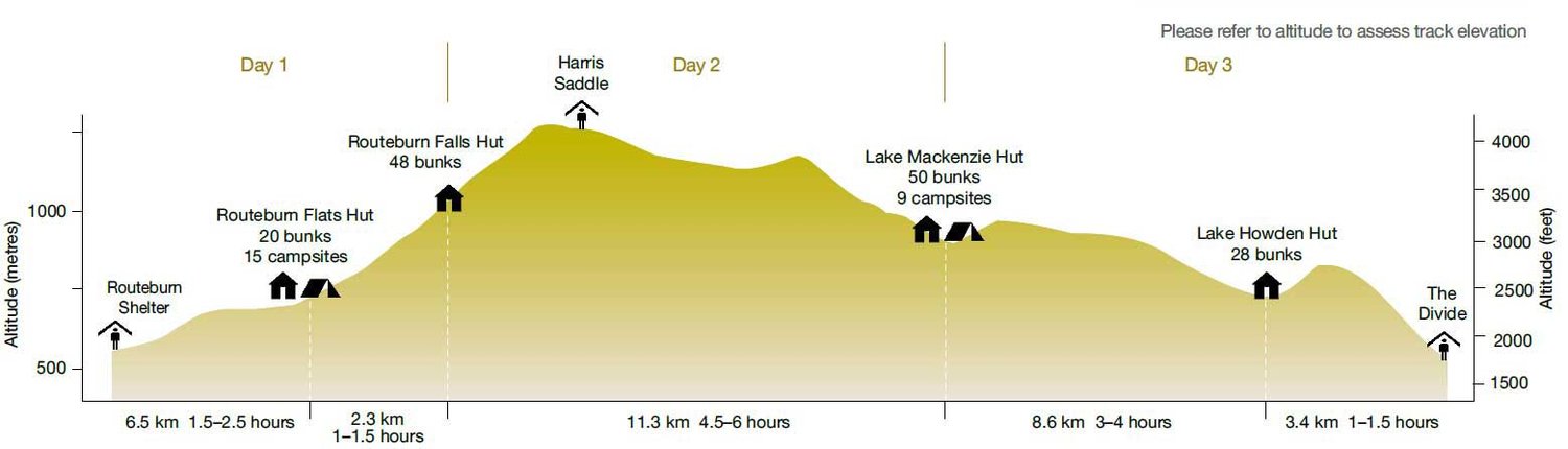
Source: Department of Conservation
In total, you gain about 750 meters but the elevation is spread out, and the hike doesn’t feel very steep.
Routeburn Track Distance and Huts
Based on the Department’s of Conservation advice, the hike is better to be attempted in the Great Walks season (1 November 2022 – 30 April 2023) because there are fewer hazards. But the huts need to be booked in advance since this track is very popular among both locals and tourists.
For more information and to book the Routeburn Track, visit this website.
Routeburn Track Itinerary
Here’s the general itinerary based on 3 days walk that most people usually do:
Day 1. Routeburn Shelter to Routeburn Falls Hut
Routeburn Shelter to Routeburn Flats Hut: 7.5 km and 1.5-2.5 hours
Routeburn Flats Hut to Routeburn Falls Hut: 2.3 km and 1-1.30 hours -> that’s the climbing part.
Most people include these two parts on Day 1 and stay at the very modern and comfortable Routeburn Falls Hut. It even has flushing toilets!
The climb towards the hut passes through the forest until you almost reach the tree line. And that’s where the Routeburn Falls and the Hut itself are located.
Day 2. Routeburn Falls Hut to Lake Mackenzie Hut
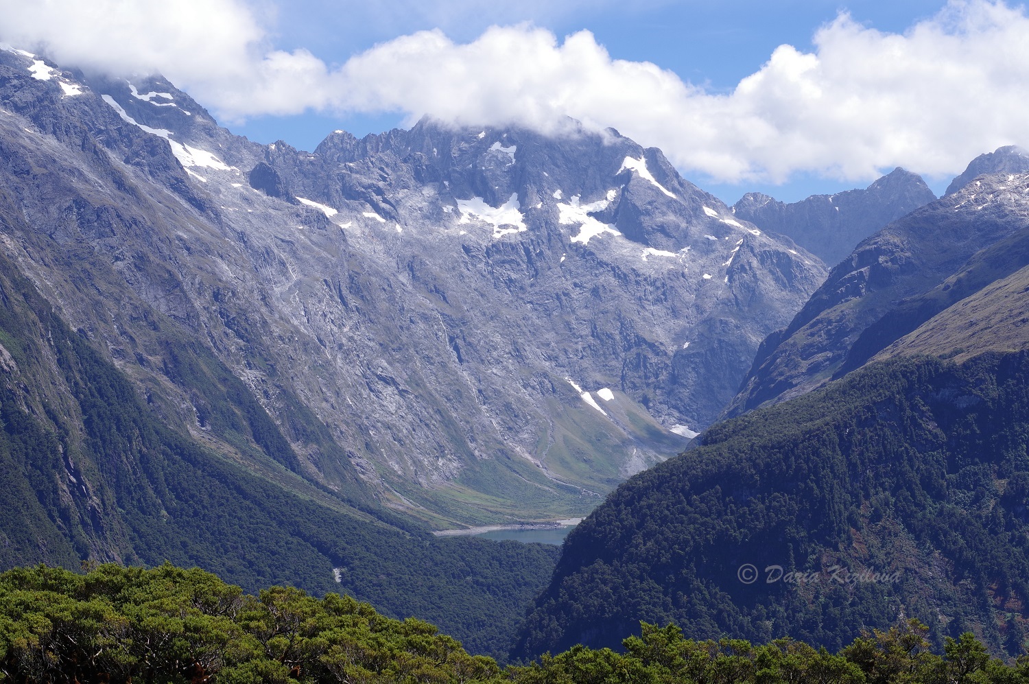
Distance and time: 11.3 km and 4.30 – 6 hours. That’s the most beautiful part of the hike climbing over the Harris Saddle with beautiful Lake Harris, and following the ridge until it slowly descends to Lake Mackenzie Hut. The views over this hut are also very spectacular.
Note: we combined Day 1 and Day 2 by making it a very long day. And we also climbed the Conical Hill (1515 m).
Conical Hill Side Trip
From Harris Saddle Shelter (located 1.2-2 hours away from Routeburn Falls Hut) you can climb up the Conical Hill. It is a relatively short but very steep hike with lots of big rocks and stones to climb over. The views from the top are just spectacular overlooking the Hollyford Valley, Lake McKerrow, and even Martins Bay and the Tasman Sea.
Time to complete: 1.5 – 2 hours return trip and just 2 kilometers (1 km each way) going from 1277 m to 1515 m of elevation.
Day 3. Mackenzie Hut to The Divide
Distance and time: 12km and 4 – 5 hr 30 min
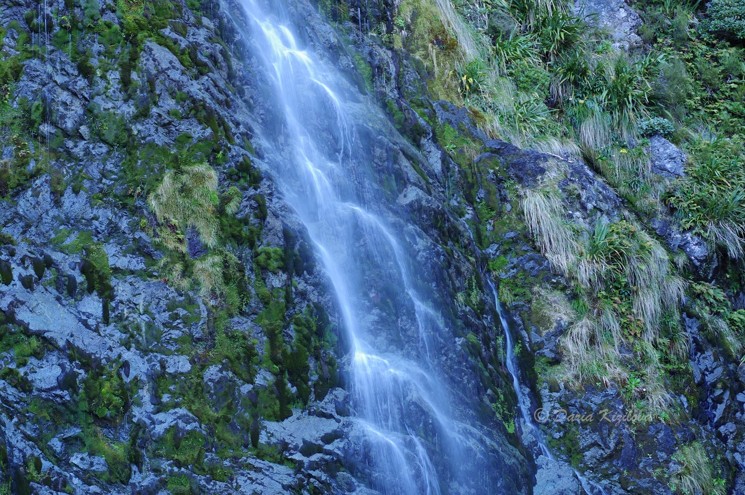
The last and easy day of Routeburn Track starts at Lake Mackenzie Hut. After a small flat area, there is a steady climb to the bush line and a gradual descent to the dramatic Earland Falls (174 m). Many people like to swim in the waterfall and that’s a good spot to have a rest and a snack.
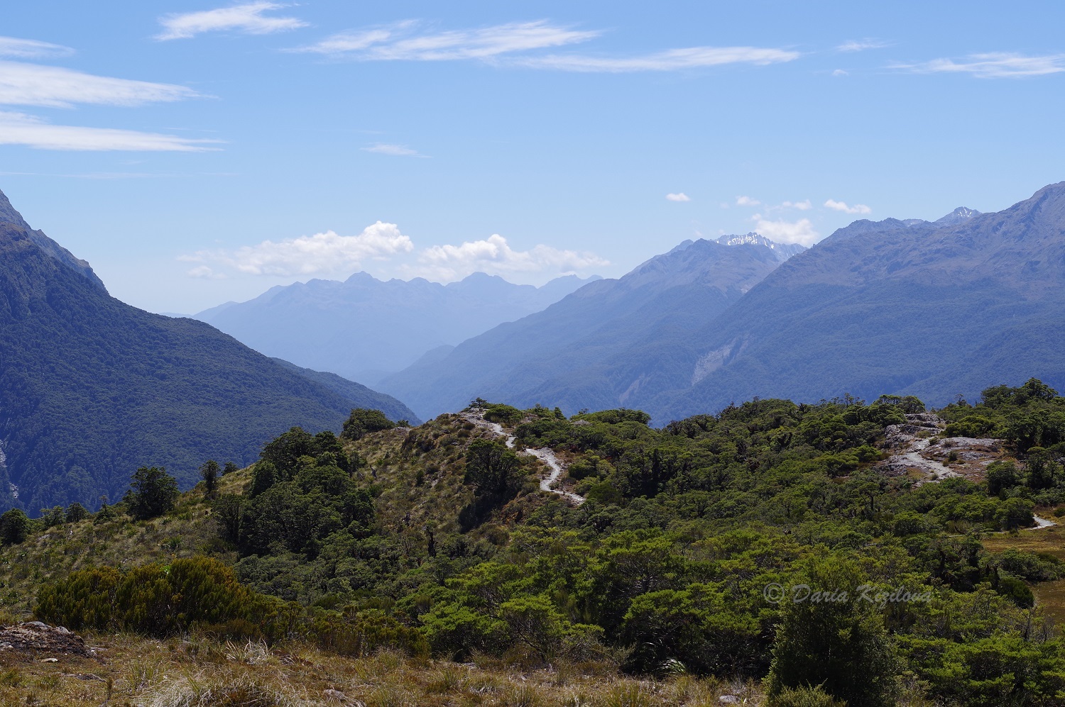
The track continues going down through beech forest to Lake Howden. And after that, it starts climbing up for 15 min to the Key Summit Track turn-off.
Key Summit Side Trip
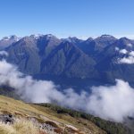
This is by far the most popular walk on Routeburn Track. It is often completed as a day walk from the Divide Shelter. After a short climb, the path reaches alpine wetlands surrounded by mountains from all sides. If the weather is good and sunny, and the sky is clear, the views over Darran Mountains and Hollyford valley are very impressive.
After returning to the Key Summit turn-off, the final part of the track starts meandering through silver beech forest until it reaches The Divide Shelter on the Milford Highway. That’s where everyone waits for the shuttle bus or to pick up their car.
How to Hike the Routeburn Track in ONE Day
Time to complete: 8 to 11 hours
If you feel fit and energetic, you may want to attempt hiking the entire Routeburn Track (32 km) in one day. It saves expenses on huts but it also provides less time to enjoy. Not sure if side trips can be done with this option. But you can definitely squeeze them in if you are fast.
If you’re lucky and the weather is sunny the whole day, it’s better to start early in the morning. You can even fly into Queenstown and get an early transfer to Routeburn Shelter, do the hike, and get a transfer from the Divide.
Most people who dare to try this option, complete the hike in 10-11 hours (the fastest was 7 hours). It may be your next challenge.
The Routeburn Track – The Must-Do Day Walk
From November to April, the Routeburn track offers rewarding views over mountain ranges and valleys while meandering via alpine gardens and reflective tarns. From May to October, the views are equally amazing but it is snowy, cold, and wet and may be very dangerous. The days are short and the winds can be pretty strong up in the mountains. The track should be only attempted by experienced hikers.
Related Posts

Categories: