What is the Kepler Track? The Kepler Track is an amazing 60 km trail in Fiordland, South Island of New Zealand. It is a truly amazing hike with the most…
Last Updated on December 2, 2023
Cape Brett Track is one of the best coastal walks on North Island! I would totally repeat it every year If there were not so many other hiking options in New Zealand.
How Long is the Cape Brett Track?
The whole hike is 32 km long traversing native and regenerating bush and offering amazing and dramatic views from really steep cliffs and turns in some sections. The hike is quite challenging physically through the path is pretty easy and maintained.
It usually takes 2 days to complete the hike (if you do the whole thing) there and back with an overnight stop at Cape Brett Hut that needs to be booked in advance. During weekends and public holidays, it can get very busy. We had to pre-book it almost 2 months in advance…
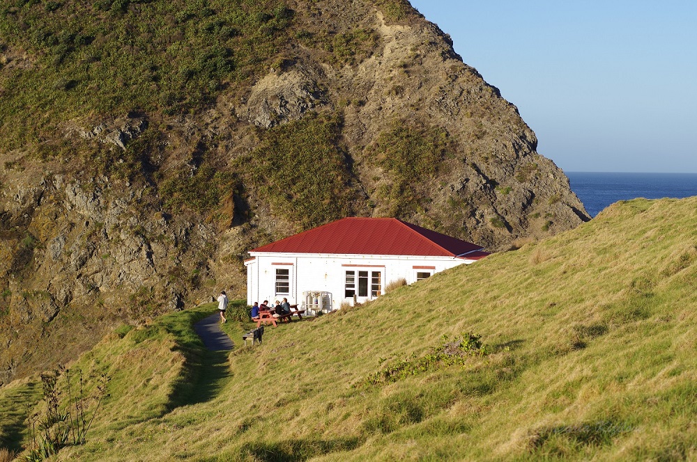
Cape Brett Hutt
Cape Brett Track Prices
Cape Brett Hut is rated as Serviced ($15) and has 23 bunk beds. You will also need to purchase a permit ($40) to cross over private land between Rawhiti and Deep Water Cove.
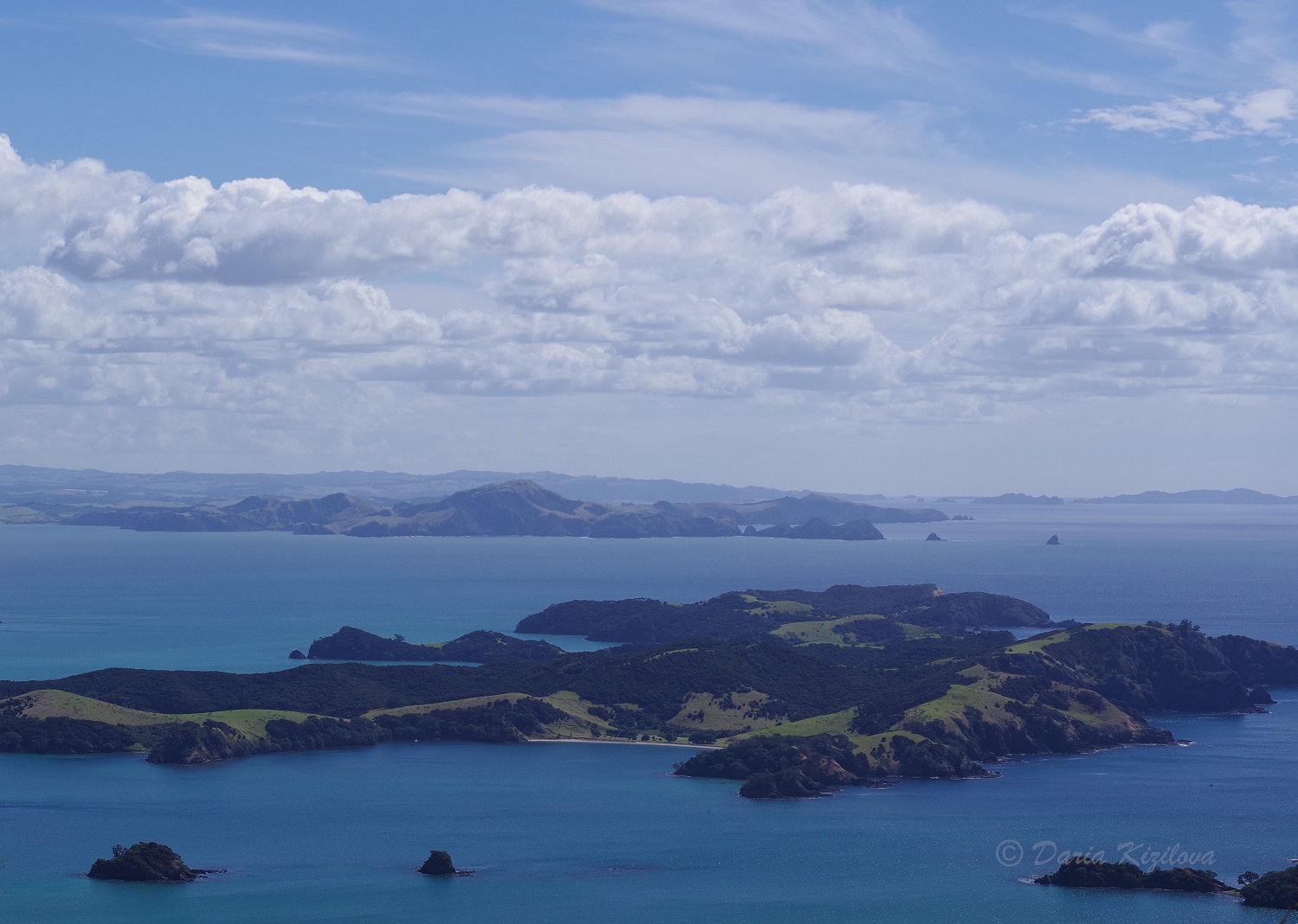
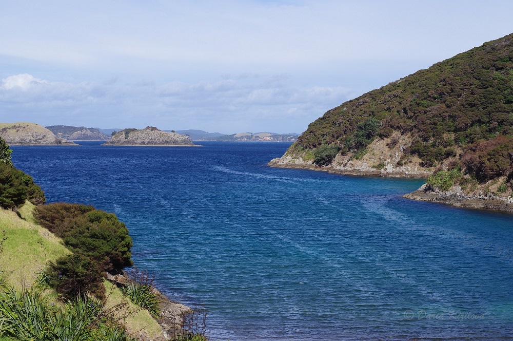
Cape Brett Track itself is located near Russell (Paihia) in the Bay of Islands. The track starts from Rawhiti, and it roughly takes 4 hours to drive to Rawhiti from Auckland. In summer when days are long, you can even start early in the morning and be there at 10-11 am to begin Cape Brett walk.
If you’re staying in Cape Brett Hut, you would leave your car overnight at one of the parking in Rawhiti (some charge $10-$20 for this) or just by the road for free (we had no issues with that).
Cape Brett Track Difficulty
Cape Brett Track is 16.3 km long one way. Department of Conservation estimates it as an Advanced tramping track of 8 hours walk one way. If you are fast and fit, you can even do it in 5-6 hours one way.
According to me, the biggest challenge of this hike is going up and down all the time. So, big hills alternate big slopes along the whole track. It is a good exercise but can be tough in the end if you’re not used to it.
Cape Brett Track Elevation
Cape Brett Track profile for elevation is quite low, it only reaches a little bit over 300 meters at the very start of the hike.
Here’s the diagram showing the elevation gain on every kilometer of one way to Cape Brett Hut.
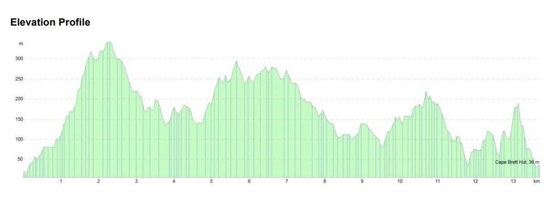
Image Source: wildernessmag.co.nz
Cape Brett Track in One Day
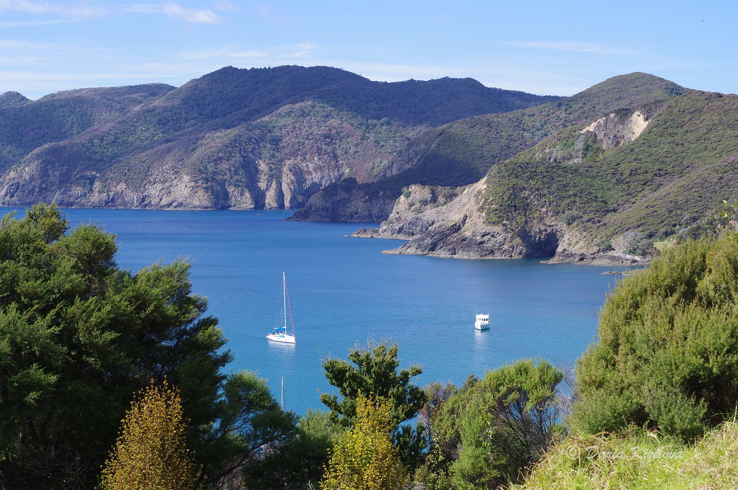
Quite a lot of people don’t venture to complete the whole hike. There’s an option to get a water taxi from Oke Bay or Paihia to Deep Water Cove and walk to the hut and back. Then to catch the taxi back.
Cape Brett water taxi one way takes 30 min and costs $60. Oke Bay is a lovely bay right next to the start of the hike. Deep Water Cove is a pristine wild beach situated close to the end of the peninsula (end of the hike). It is known as a marine reserve and has a bunch of different fishes there. I snorkeled and enjoyed this place!
Deep Water Cove Beach
It is a 2-3 hours walk from Deep Water Cove beach to Cape Brett Hut one way. I think it is the most beautiful part of the hike as the path starts to open up from the bush offering extensive ocean views, picturesque cliffs, and bays. And of course! The Cape Brett lighthouse is amazing. Meeting the sunrise or the sunset on the little platform by the lighthouse would be unforgettable!
Oke Bay – near Rawhiti Road when the hike starts
Walking the Cape Brett Track
The hike starts from Rawhiti road with a straight uphill to Mount Pukehuia (345m). There is a nice view and a toilet after you reach the mountain. The track keeps following the ridgeline all the time. After a few minutes, Cape Brett Track branches off onto Whangamumu Te Toroa Loop Track.
What to See on Whangamumu Te Toroa Loop Track
This hike takes you down to Te Toroa Bay where you can enjoy views and interesting plant life. If you go further, you reach the old Whangamumu Whaling Station and a deserted Whangamumu Bay which is only accessible at low tide. In the old times, they used to catch whales with nets here. It was the only place in the world. They placed nets across the channels where whales used to swim. When they trapped them, they harpooned the poor animals and took them to the Whaling Station where they were processed.
After Whangamumu Bay, the path either takes you back to Cape Brett Track or keeps going towards Rawhiti road by wetlands. It is a different spot from the official Cape Brett walk start.
Unfortunately, the whole Whangamumu Te Toroa Loop Track was closed due to maintenance when we were there…
Let’s Go Back to Cape Brett
So, after you climb Pukehuia, stop by the viewpoint and pass the turn to the Whaling Station, the path keeps meandering through the bush up and down. Along the track, there are marker posts every kilometer to keep you motivated. At some point, you go through a tiny gate marking the start of the private land (I guess).
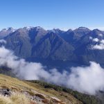
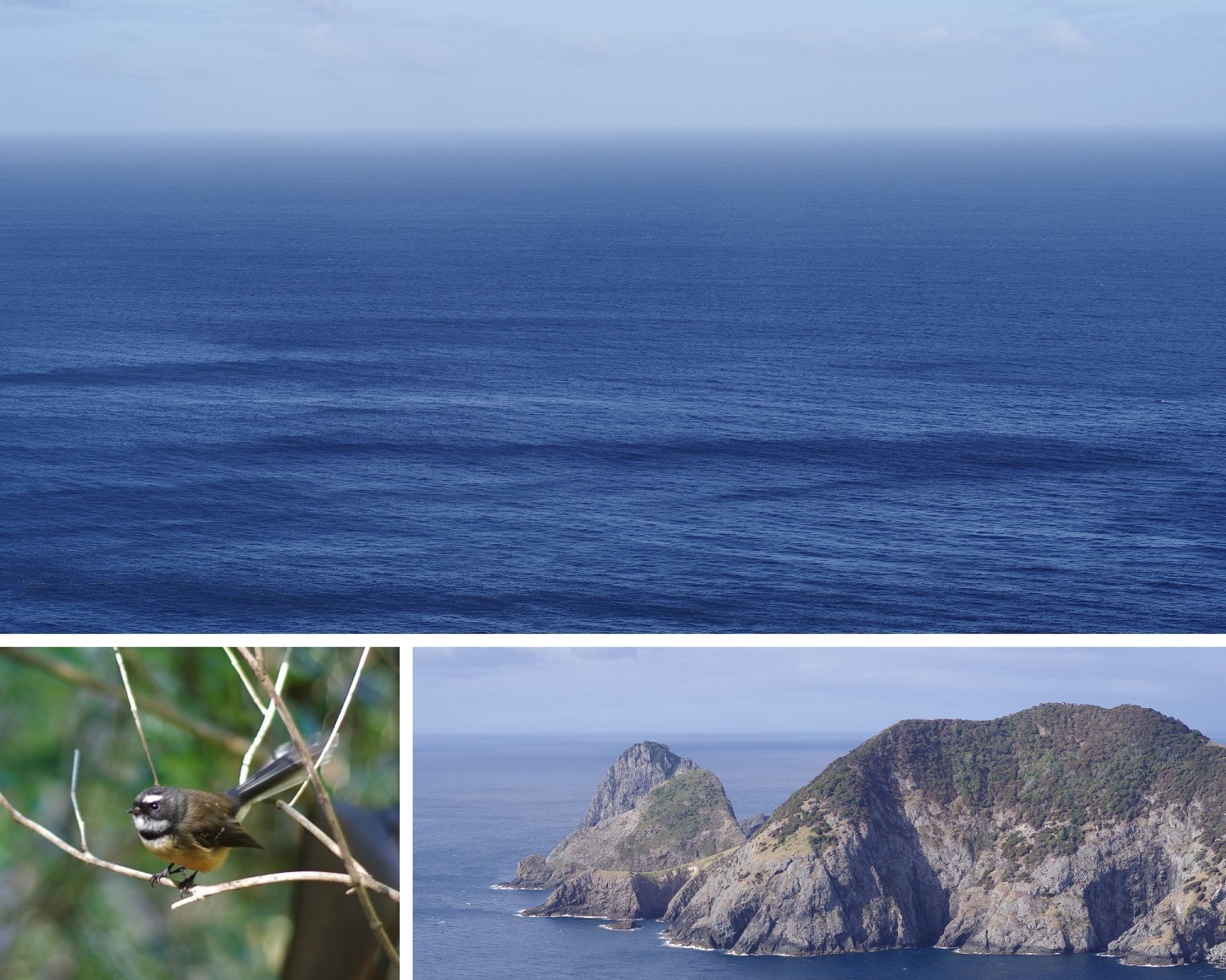
Most of the time, the hike is covered by the bush. When you come across clearer sections or lookouts, you may be able to see great coastal views as well as some fish, dolphins, and seals if they come up close to shore. There are plenty of native birds in this area too. There are electric fences as pest controls against possums along this section.
After passing the turn where the path goes down to Deep Water Cove, you may enjoy the most picturesque part of the hike. It is also slightly more dangerous as there are a few drop-offs and high cliffs. But nothing major.
Cape Brett Track Views
Deep Water Cove Side Trip
The Deep Water Cove is a side trip that takes you down from 110m to sea level and can take 1-2 hours return. It is absolutely worth venturing to the beach, by the way, you can leave your pack behind if it’s too heavy.
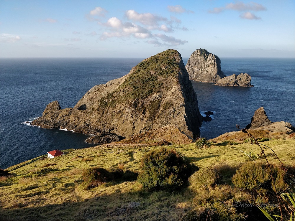
Walking on the Cape Brett ridge, you can see Motukokako (Piercy Island) which has a famous “hole in the rock”.
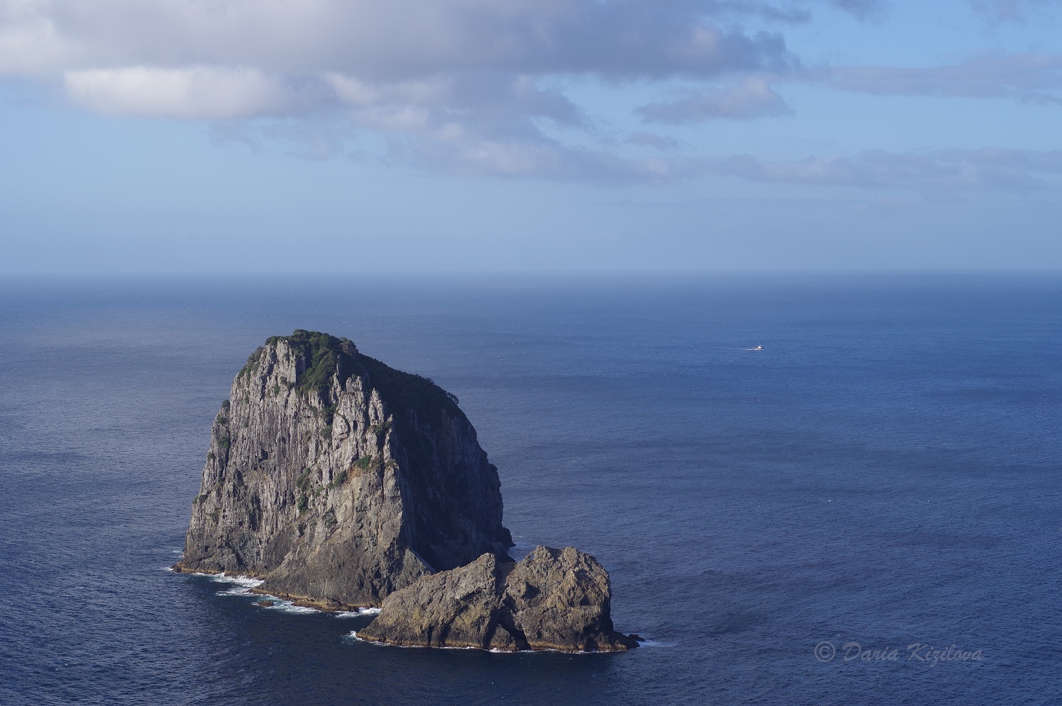
Motukokako Island
Cape Brett Lighthouse and Hut
Cape Brett Lighthouse is the last scenic place on the hike before the Hut itself. It was built in 1910. Its huge clockwork mechanism was used until 1978 when it was replaced.
Finally, the path goes down to Cape Brett Hut (such a relief!). The views over the hut and the cliffs are just spectacular. It’s one of the most beautifully located huts I’ve ever been to! It’s situated at the very end of the Cape Brett peninsula overlooking the ocean and Otuwhanga Island.
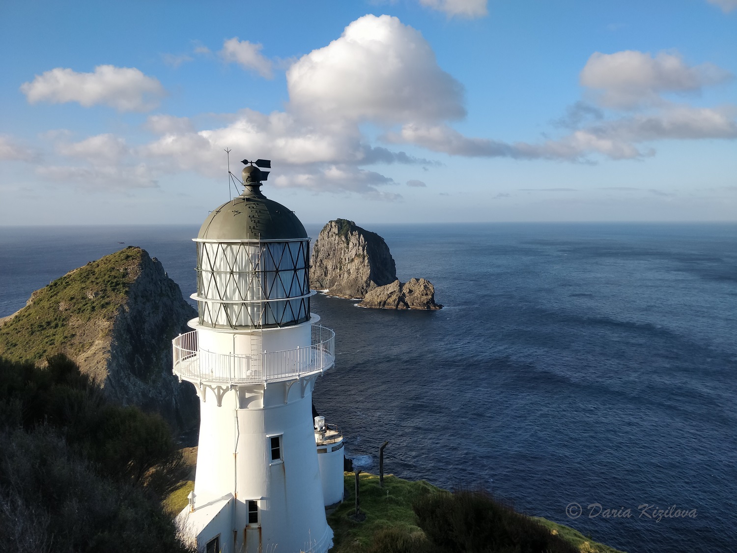
Cape Brett Lighthouse
Going Down to Cape Brett Hut
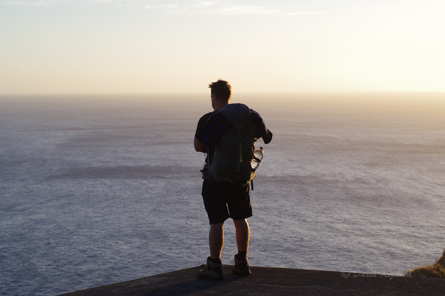
If you reach this section in the lower afternoon light, it makes the views warm, heavy, and deep in color. Walking around the hut at sunset was my favorite time during this hike! And the night sky is truly dark and totally mesmerizing!
Walking Back is a Pleasure
Start your morning early to enjoy the sunrise by Cape Brett Lighthouse on the platform. Walking back is similar in distance and time, with accumulated tiredness. The best section of the hike (from the Hut to Deep Water Cove) will now be enjoyed in lucid and transparent morning lights.
For the hike back, an easier option is to take a water taxi to Paihia from Deep Water Cove. A tougher option is to include the Whangamumu Te Toroa Loop Track on the way back adding up extra 12 km.
Related Posts

Categories: